What does your mind recall when some asks “Who lived in Europe before the Romans?” Do you think about ancient ruins; maybe stolen Greek culture; or maybe a little fact or two about that one old-old civilization called Phoenicia something or other? We all are familiar with the empire’s northern limits in the United Kingdom (Hadrian’s Wall, Roman baths in Bath), and it makes sense that the Romans probably traveled as far west as possible into Portugal and Spain. But if we probe deeper beyond surface, a question arises with no familiar answer: Who lived in Western Europe before the Romans?
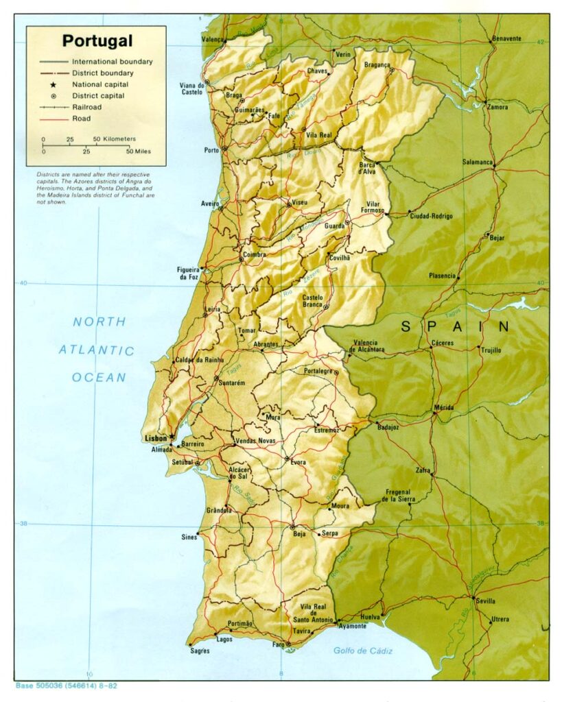
Our journey into northern Portugal takes you to the ruins of Citânia de Briteiros, a 3,000-year-old bronze-age settlement, established well before the legendary founding of Rome. Along the way, you will learn about the many tribes and cultures that lived in the Iberian Penninsula and see how the remaining archeological settlements piece together a time before recorded history.
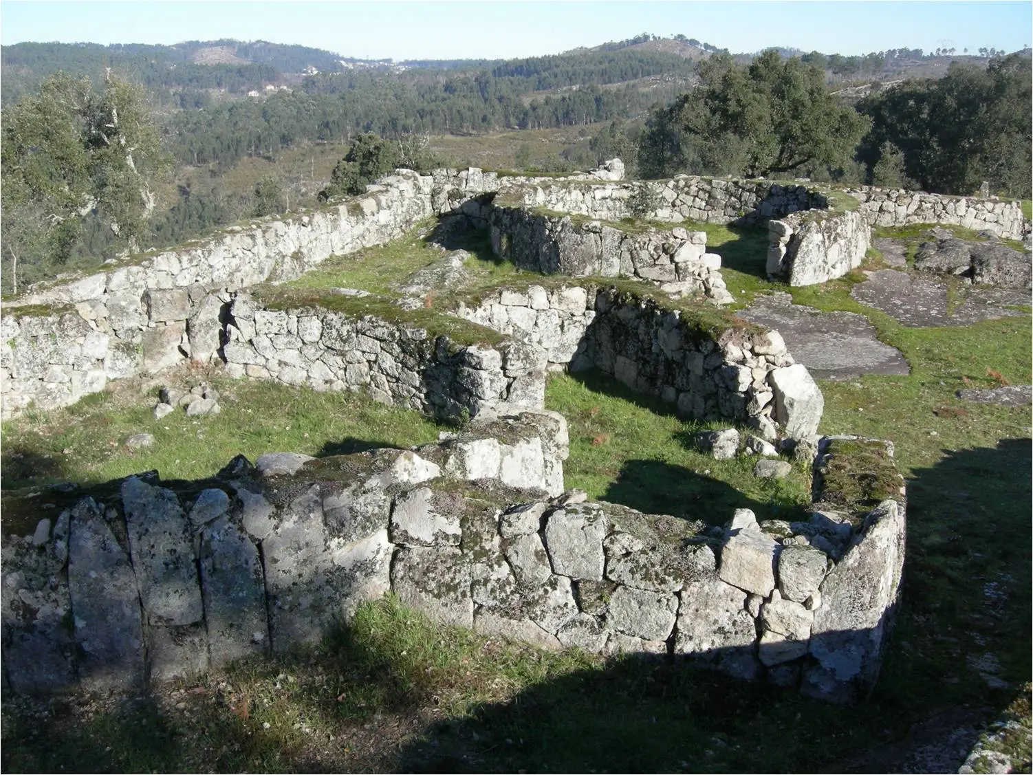
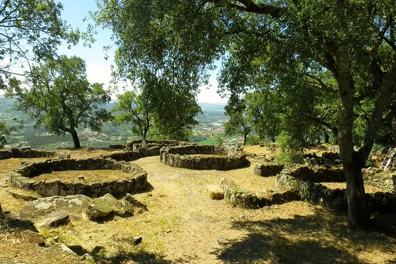
In my previous articles on Peneda-Gerês National Park and Sanctuary of the Sacred Heart of Jesus, I briefly touched upon the Castro Culture, a term used to describe the Celtic tribes who lived in circular stone huts during the Atlantic Bronze Age to early Roman occupation. During this period, the Iberian Peninsula was co-inhabited by many tribes. While some were in constant war with each other, many were established communities with proto-urbanism development and trade routes.
Along the Mediterranean coastline in the south, the Turdetanians were the most developed. They had their own alphabet, written records, and rule of government. When the Phonecian’s arrived around the first millennium BC, the Turdetanians were eager to establish trade, and became the point of first contact for “western civilization.”
If we move north to our destination, the rugged terrain plays a pivotal role in gauging temperament among tribes.
According to Roman historian Strabo, many of the small tribes in Gallaeci (Northern Portugal + Western Spain) were geographically isolated and as such were “socially awkward and always warring with each other.”
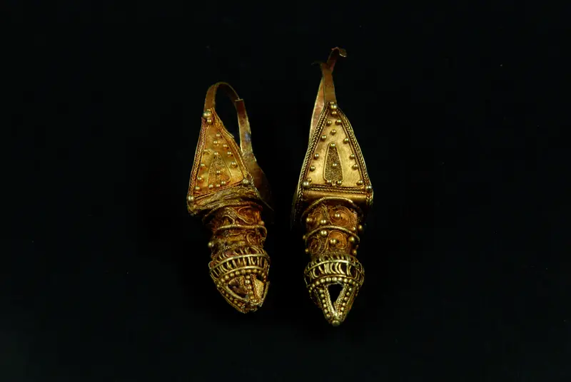
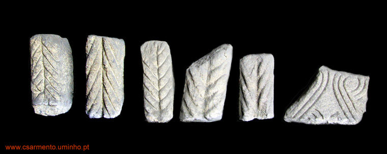
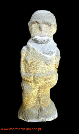
These tribes were considerably smaller and localized to only a few mountain tops. The many castros situated among the peaks are believed to be fortifications for trading routes throughout the region, connecting many different tribes together.
The circular stone huts, paved roads, and fortified walls demonstrate an established, structured and singular objective for survival and profit: maintain a route of trade and protect the means of production; fish, timber, wheat, barley, fruits and livestock, were some of the resources produced here.
Citânia de Briteiros is an expansive example of an established castro. A few miles east of the modern day city of Braga, Briteiros is built on a promontory ~500ft above the Ava River. Like other Castros, it offers brilliant vistas of the valley floor to the east, and the mountain chain to the west, suitable for observation of any incoming enemy invaders.
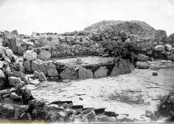
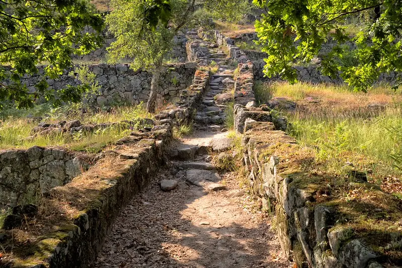
The expansive site measures ~60 acres (24 hectares) and includes unique examples of paved walkways, a council house, sauna, and layers of ramparts that we will discuss below. It is an incredible site that demonstrates advanced structures and city planning for the time period.
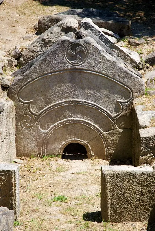
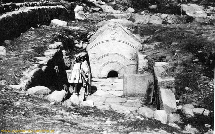
The most notable discovery of this site is the Pedra Formosa, a stone carving of monolithic weight believed to be the front piece of an ancient sauna.
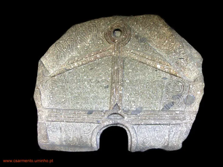
Reading through several sources, I am still unsure as to the confirmed meaning of such an artwork; symbolic of religion, death, or a cleansing wash after a muddy day, it serves as an important piece of ancient discovery that begs to question the origins of bath houses as communal activities prior to Rome.
Alongside some of the paved pathways, there appears to be a small drainage channel next to the adjacent ramparts which prevent erosion. This innovation is unexpected for a late bronze age civilization, and the question of Roman influence compared with historical dating of certain parts of the settlement remain under debate.
The ramparts display another testimony to prehistoric engineering, constructed with thick stone and no mortar. In some locations at 4+ meters in height, they have remained in place for THOUSANDS of years.
Finally, the largest structure known as the council house is believed to be a place where the village elders, or wealthy heads of certain families would discuss future plans for the community (similar to the large teepees used by Native Americans).
Despite the impressive city planning, Roman conquest was inevitable. While many of the southern tribes assimilated into the new empire, northern tribes resisted the occupation. During the reign of Ceaser Augustus in 16 B.C., troops invaded and defeated the local Callaeci (Gallaeci) tribe and renamed their city to Bracara Augusta (modern day Braga). Citania de Briteiros was overthrown, repopulated, and inhabited by Roman civilians for the next 200-300 years.
After the fall of the Roman Empire around 300 A.D., the site was abandoned until the 10th century, when a hermitage, Capela de São Romão, was built amongst the stonework, and still stands today.
When you walk along the pathways through Citânia de Briteiros, the stories of this site tell you of a developed civilization that lived over 3,000 years ago. While my western culture talks a lot about the influence of the Roman empire on society today, archeological sites such as these remind me of the cultures who assimilated with or were conquered by the Romans, before the word roman became a household catchphrase.
When you realize the story of humanity’s journey across earth appears in unassuming regions, across all continents, and without written records, it is fascinating to think about people who lived in the rugged northern hills of Portugal, tucked away in what could be the last pocket of Western Europe to become inhabited by mankind.