
Peneda-Gerês National Park (Parque Nacional da Peneda-Gerês)
Overview
In a circular fashion, a visit to Peneda-Geres National Park (PGNP) can begin with prehistoric settlements and progress through Roman paths, Medieval Castles, and beautiful mountain views. They take you back in time to glacial periods that shape unique geological landforms. Where local Portuguese travel to escape within vast granite forests tucked away from bustling tourists, Peneda-Gerês offers rugged and relaxing destinations that span the breadth of European history and geology.
Editor's Note
With such an expanse of notable locations, arching across nearly every time period without any geographical delineation, I will attempt in this article to list the destinations in chronological order. In the interactive map below, locations are grouped and Initaled by Specific Ages:
- PH: Prehistoric – 300 BC
- RR: Roman Rule – 300BC – 500 AD
- MP: Medieval Period 500 AD – 1500 AD
Google Maps
Roca Negra
PH: Megalithic Necropolis
RR: Geira Via Romana
MP: Castelo de Lindoso
MP: Castelo de Castro Laboreiro
Geography
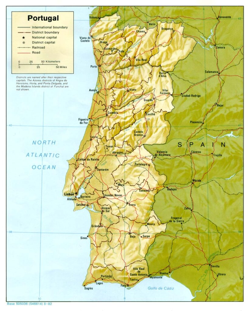
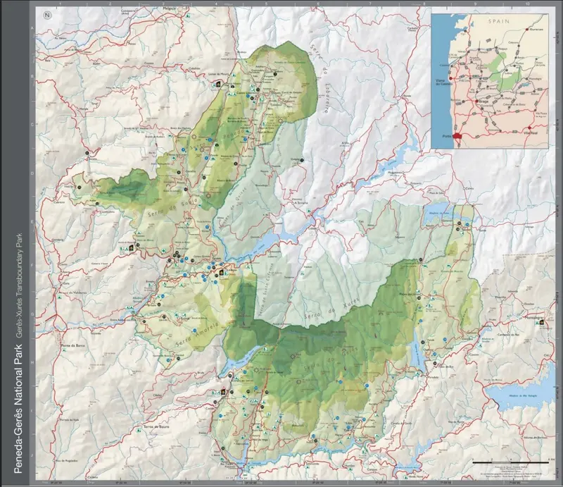
To understand the layout of the park, let me begin with a broad overview of the local and regional topography. The national park’s boundaries interweave with 3 mountain ranges (Serras) listed geographically from North to South:
- Peneda
- Amarela
- Gerês
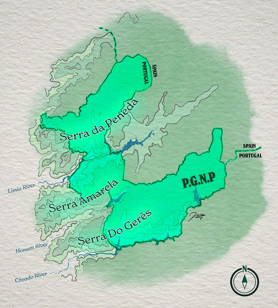
Together, they contribute to the westernmost fingers of the NW Range in the Iberian Peninsula. For perspective, the NW Ranges and Cantabrian Mountains (a little eastward) are the Northernmost boundary of the commonly discussed dry Meseta Central region of Spain. These ranges are responsible for capturing the cool, moist clouds from the Cantabrian Sea in the north (the part of the Atlantic Ocean between Spain and France) before they reach the Iberian interior.
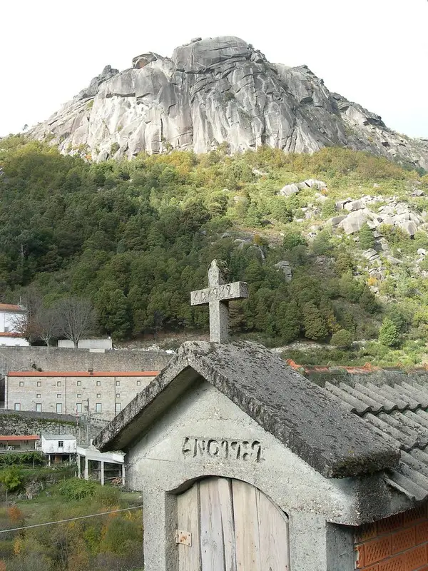
These Serras consist mostly of granite, with recognizable landmarks called bornhardt landforms (aka medas, borrageiros), structures of rock that stick out like hills above the mountain plane (such as Roca Negra [Black Rock])
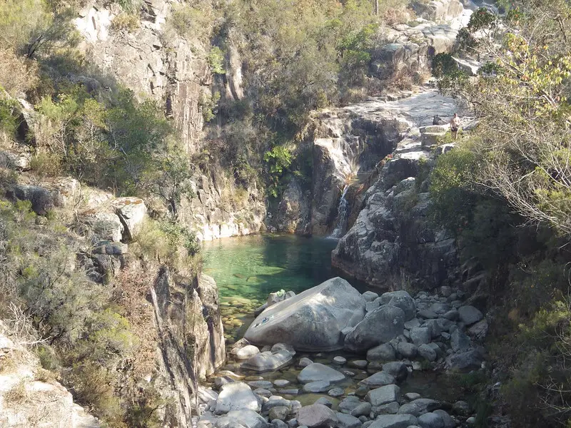
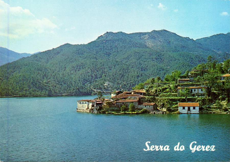
Several tectonic movements over the course of history attribute to the sharp elevation gain between mountain-top and valley floor. This high-contrast ratio results in a number of beautiful waterfalls reaching up to 100 ft (30m) in height. Some examples include Pitões das Júnias, Arado, Portela do Homem, and Poço da Gola.
Evidence supporting the claims of glaciation include various examples of moraines, glacial lakes, granite boulders, and terminal valleys.
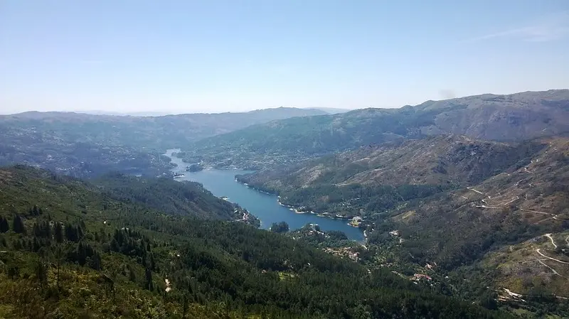
With elevation ranging between 1000-1550m (~3280-5080ft), PGNP captures the above-mentioned moisture from the Atlantic and becomes an ecosystem of untouched natural habitation, including the Albergaria Forest in Serra do Gerês.
Prehistoric History
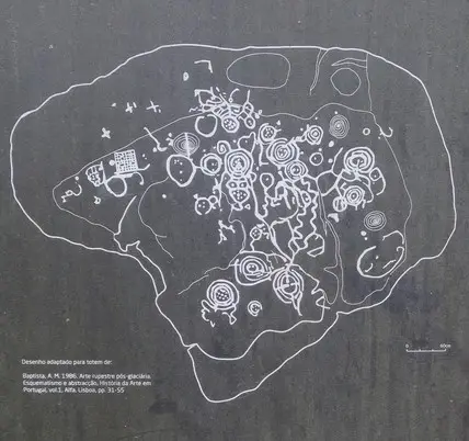
The earliest settlers of northern Ibera are believed to be traced between 3,000—2,700 BC due to examinations of Galician and Schematic rock carvings. Large burial tombs, or Megaliths, are the most preserved forms of evidence to these early settlers. One such example is the various remnants of the Megalithic Necropolis (Serra da Peneda), a collection of dolmens (Burial chambers made from massive stone slabs) dating to the Bronze Age.
What is Galician/Schematic Art?
Galician or Atlantic Art is a form of rock art used during the Bronze Age. It is found across regions spanning from England in the north to Northern Portugal at the Southern extreme. Schematic Art finds its roots in the same time period, but intersecting the Portugese Spanish border as its northernmost terminus, and southeast towards the Mediterranean.
Roman Occupation
The first recordings of Roman presence in the region were 215 BC, followed by constant push back from the Bracari natives. The conflicts led to the construction of a brick road enforced by the Roman army for transportation of troops and supplies.
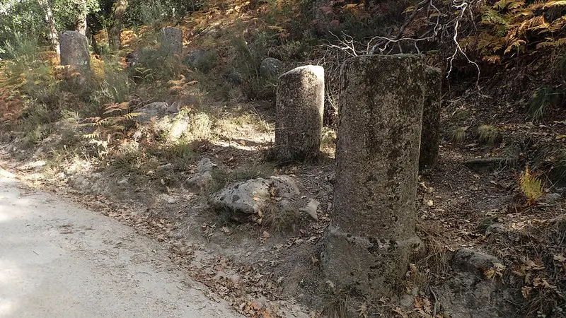
Even after Roman occupancy was dismantled in the 5th century AD, the brick route was well maintained. As a testament to Roman preservation, milarias (milestones) were erected with carved inscriptions—akin to a modern-day hiking trail.
Today, it is known as the Geira Via Romana XVII (or Via Nova) and traverses a total of 315 km, with approximately thirty Roman milarias following Serra do Gerês in the PGNP.
Medieval Period
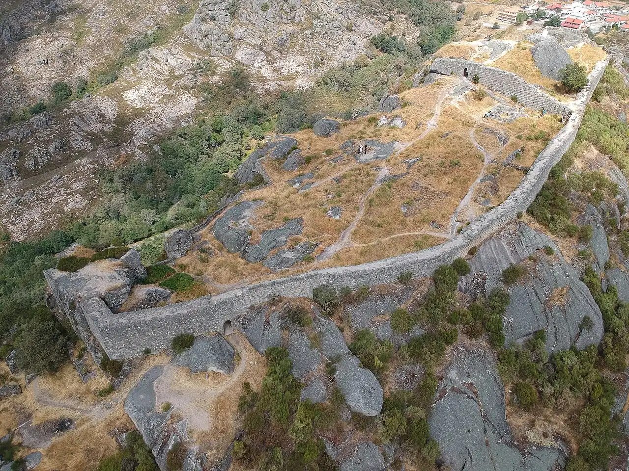
Notable castles within the PGNP include the ruins of Castelo de Castro Laboreiro (Serra da Peneda). Notable for its morphology clinging alongside the edge of a mountain, Castro Laboreiro is believed to be a strategic position continually inhabited since the Bronze Age. Between 800–1800 AD, this defensive Romanesque stronghold exchanged in the hands of Moorish rulers, lords, knights, and kings.
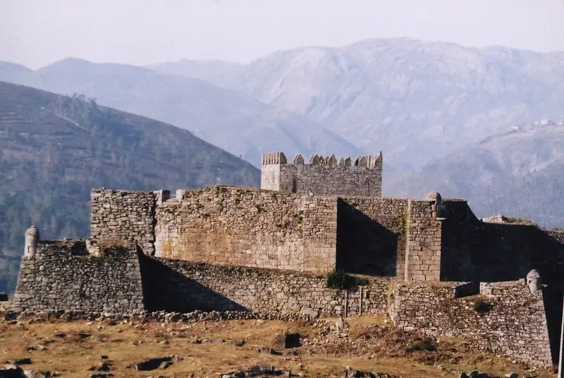
Further south near the Lima River (in the valley between Serra da Peneda and Amarela) lies Castelo de Lindoso, a Romanesque/Gothic fortification built to protect the Lima during battles between Spain and Portugal.
Conclusion
Peneda-Gerês National Park is a conglomeration of time immemorial. In one afternoon, you can traverse 3,000 years of history across mountain peaks, and relax your weary feet under a waterfall at dusk. Tucked away near the border of Spain, the park serves as a reminder of the beautiful history of the Iberian Peninsula, the many cultures that passed through, and the lasting adventures you can make among the granite peaks.
References
Pereira, P., Pereira, D.I. (2020). The Granite and Glacial Landscapes of the Peneda-Gerês National Park. In: Vieira, G., Zêzere, J., Mora, C. (eds) Landscapes and Landforms of Portugal. World Geomorphological Landscapes. Springer, Cham.
Oliva, M. et al. (2022). The Iberian Peninsula. In: Oliva, M., Nývlt, D., Fernández-Fernández, J.M. (eds) Periglacial Landscapes of Europe. Springer, Cham.
Oliva, M., Fernández-Fernández, J. M., & Palacios, D. (2021). The Iberian Peninsula (except for the Pyrenees). Elsevier EBooks, 129–133.
Alves, L. B. (2010). Signs on a Rock Veil: work on rocks, ‘prehistoric art’ and identity in North-West Iberia. In B. O’Connor, G. Cooney, & J. Chapman (Eds.), Materialitas: Working Stone, Carving Identity (Vol. 3, pp. 169–180). Oxbow Books.
Pereira, E., Queiroz, C., Pereira, H. M., & Vicente, L. (2005). Ecosystem Services and Human Well-Being: a Participatory Study in a Mountain Community in Portugal. Ecology and Society, 10(2).
Augusto Pérez-Alberti. (2021). The glaciers of the Peneda, Amarela, and Gerês-Xurés massifs. Elsevier EBooks, 397–416.
Websites
- Largo do MunicípioRock Engravings of Bouça do Colado
- PNPGeres.pt
- http://www.monumentos.gov.pt/Site/APP_PagesUser/SIPA.aspx?id=444
- https://www.castelosdeportugal.pt/castelos/castles/CastlesSECXIII/lindoso_en.html
- https://visitpenedageres.blogspot.com/p/home-page.html
- https://www.casiaventurilla.com/mata-da-albergaria-y-via-geira-romana/
- https://www.portugalthings.com/how-to-hike-in-mata-de-albergaria-in-geres/
- https://www.castelosdeportugal.pt/castelos/castles/Castles(pre)SECXII/castroLaboreiro_en.html